|
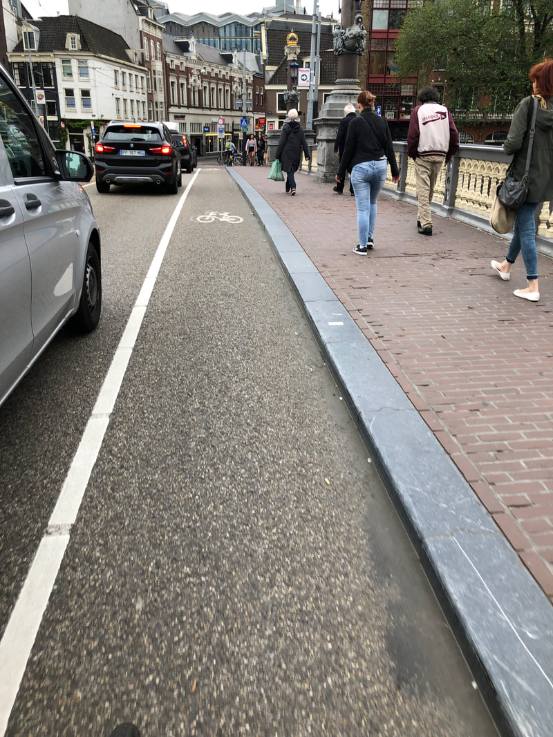
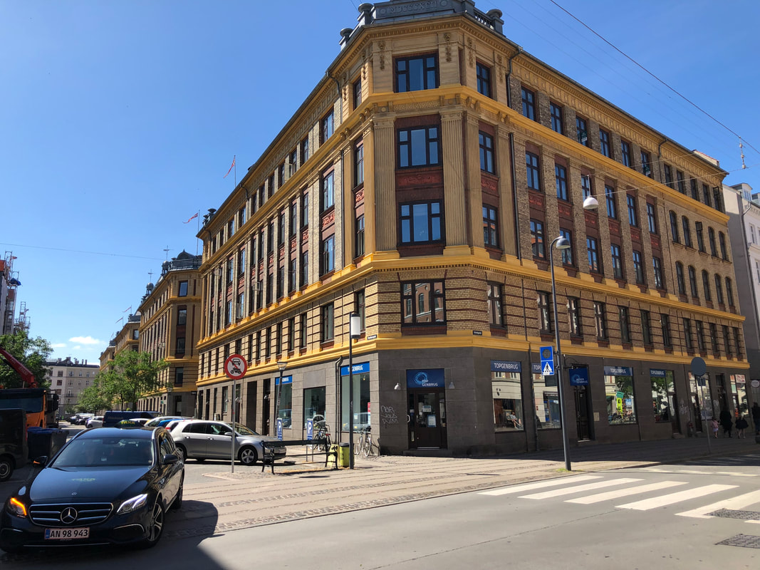
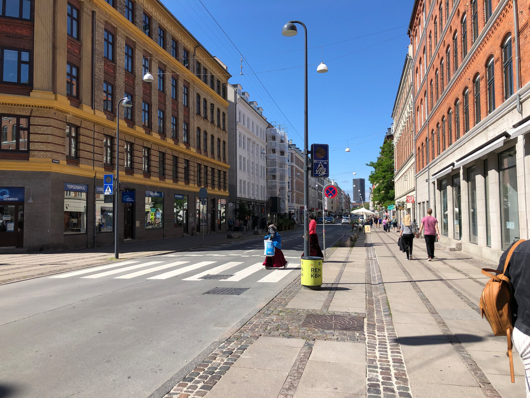
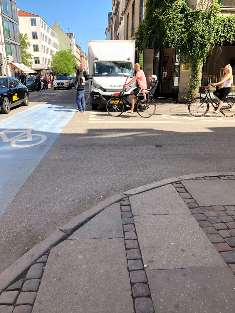
After 2.5 days in Amsterdam, I was ready for a slightly quieter, calmer Utrecht. As I alluded to in my previous post, for all of the order in Copenhagen, Amsterdam is the except opposite when it comes to transportation. Bicycle facilities start as one-way cycle tracks, transition to on road painted lanes, then disappear for a block or two and share lanes with cars, then switch back to two way cycle tracks. Red lights appear to be suggestions for the Dutch on bikes, and the majority of smaller intersections (i.e. unsignalized) don’t have any guidance (no yield, stop in any direction, etc.).
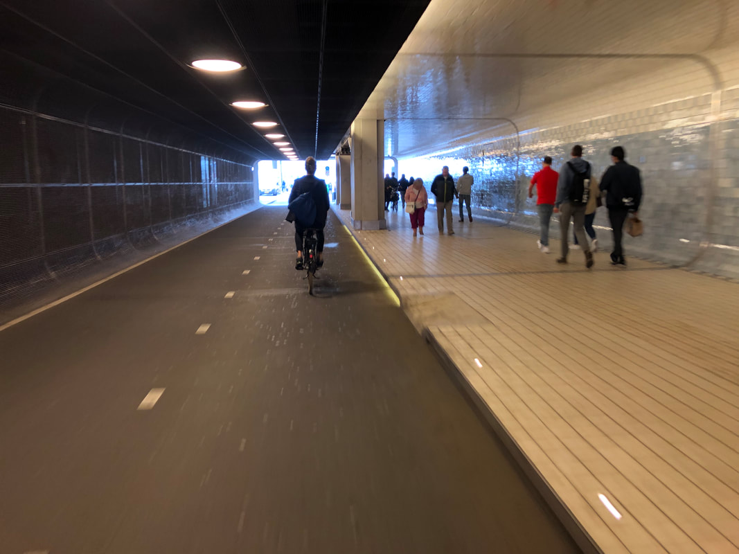
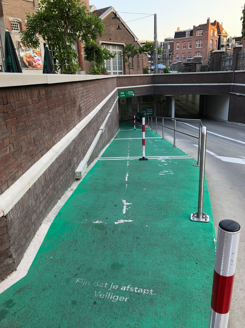
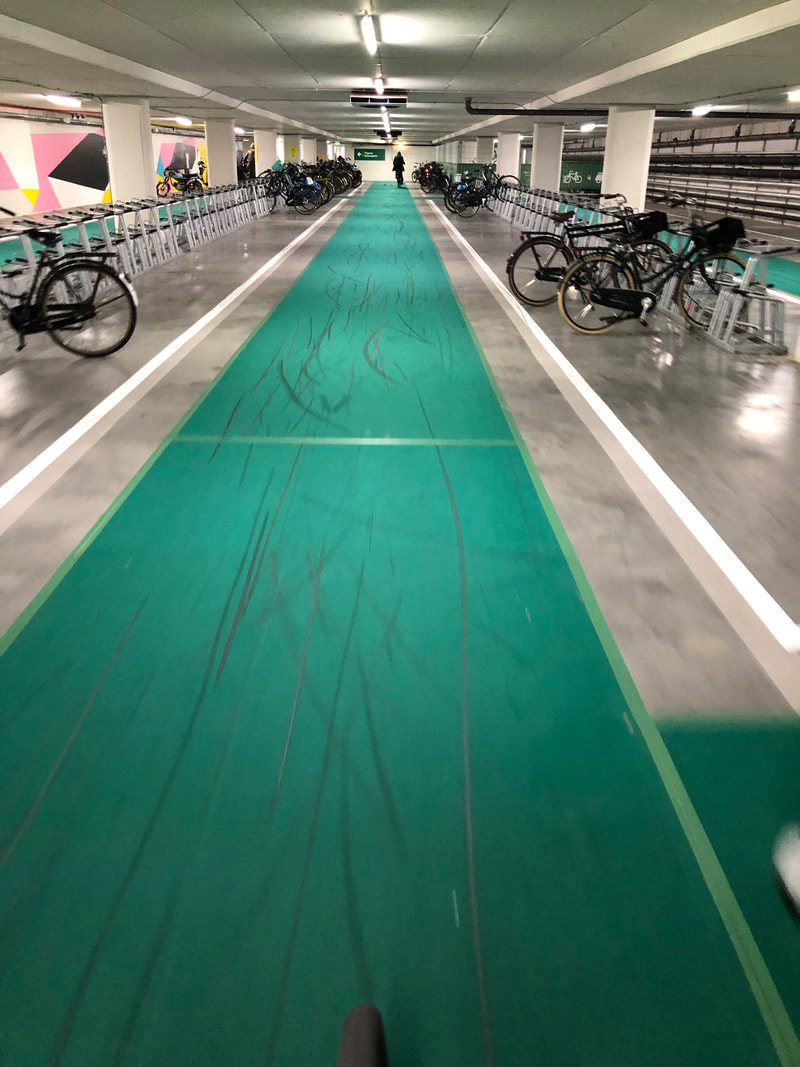
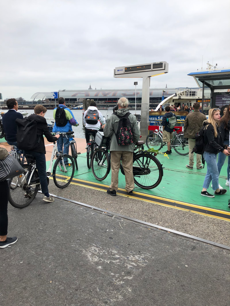
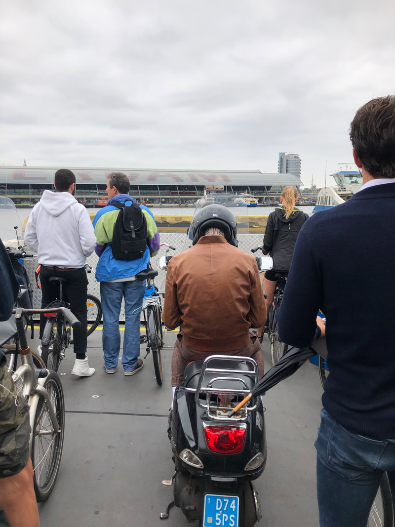
I thought coming from Copenhagen I would be ready—but I clearly wasn’t! On top of this, the relatively small city of Amsterdam (800,000 people in the city proper) receives 18 million visitors a year, so around the Central station and downtown core is even further chaos. All that being said, while getting around was more complicated, the Dutch appeared to have better bicycle amenities then the Danish, mainly bicycle parking. One evening I went to a food hall that was in a converted warehouse. The parking is underground, but more than half of it was dedicated for bike parking, and there was a ramp in/out of the garage. Stairs from the bicycle parking then went straight up to the food hall, a major convenience for people cycling. The other interesting feature was a bike on/bike off ferry to connect North Amsterdam from the rest of the city! The ferries run 24 hours a day every 4-5 minutes, which on one hand seems expensive, but on the other it a natural transportation reaction for people that bike between the north part of the city and remainder. I have joked with a few people about running a water taxi between Corvallis and Albany along the Willamette, but after seeing this ferry I think it could be a reality! The next few days I’ll be in Utrecht and likely taking a break from blogging until I head home on Saturday. Utrecht is well known around the world for cycling culture (see Streetfilms video from Utrecht below) so I’ll share more thoughts as well as some idea for bringing this back to the region. We'll also be meeting with staff from the City, so if you have any more questions, drop them in the comments below!
0 Comments
Our guide for this trip, Adam who lives in The Netherlands (Holland) told us the that "Copenhagen in the cycling city, but Holland is the cycling country," I think he meant that Copenhagen has better infrastructure within their city, but overall Holland has an extensive path and route network country wide. After riding around both the city of Amsterdam this morning and using the route network this afternoon, I would whole-heartedly agree. Amsterdam takes a different approach to cycling infrastructure than Copenhagen. While Copenhagen matches the cycle facility to road type (the bigger the road the better the infrastructure), and focuses primarily on one way cycle tracks, Amsterdam uses a mix of painted lanes, shared lanes, separated cycle tracks and two way cycle tracks. It makes for a lot more confusion, which I'll explain in another post. However, the rural route system is pretty, shall we say, magical. Most intersections of paths have wayfinding signs directing you to nearby (or far) communities connected via the path system. Once you're between cities, there are numbered junctions, each with a map of the surrounding network and mileage to the next junction. While not necessary for commuters, these features welcome recreational cyclists and can encourage locals to go for day trips, increasing their physical activity. The route also makes the best of what's available. So in high use areas of the city, it's a wide one way or or two way cycle track. As you transition through neighborhoods and lower density areas, it follows local streets that are low volume and low speed (and probably one way but I couldn't tell for sure). Finally, when you're in the more rural areas, it's either a relatively narrow two way path, or shares the road for short sections with vehicles. This type of approach may not be suitable for riders of all abilities and that is certainly something to consider when building cycling infrastructure. While I'm immediately thinking of the Corvallis to Albany bikeway, it also reminds me of some incredible opportunities for smaller communities both inside and outside the CAMPO region and how a network like this could not only provide a safe, non motorized vehicle way to travel between cities, it could also attract tourists and spur economic development. What do you think? Would you like to see a network like this in the Corvallis/Benton County/Willamette Valley region? Warning: long, text heavy post! As I told people about this trip I received multiple comments along the lines of "Corvallis is not Copenhagen," "the United States is not Europe," "the socialist countries pay more taxes so their budgets are different/bigger," etc. And a good friend of mine who is also a planner and following along posed a number of questions related to similarities, land use densities, suburbs, public processes, etc. So, I thought I would take some time to address as many of those assumptions and questions as possible in hopes of providing context and convincing folks there are more similarities than differences. Or at the very least, applicable lessons. So tackling these one by one, I give you Zach's questions:
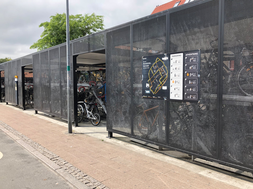
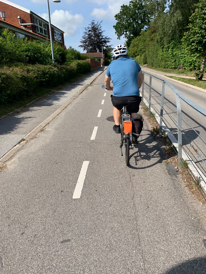
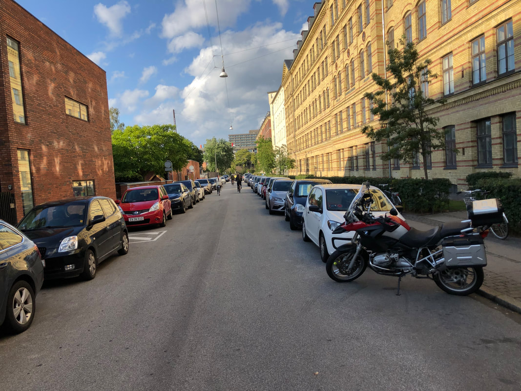
I will be speaking with Dutch officials later this week, so this post is mostly focused on what I learned about Denmark/Copenhagen. For sources, I used World Population Review, which I haven't verified but using some spot checking I think it's close enough for comparison. 1. Are there Dutch/Danish suburbs? 3. How are land uses and densities different in downtown Copenhagen v Portland or Corvallis? The density question. Copenhagen proper has a population density of 12,000-15,000 people per square mile, which is significantly higher than many US cities (somewhere between Boston and San Francisco). However, when you get outside the city limits and into the urbanized region (i.e. US equivalent of an MPO region), the population density drops to approximately 5,000 people per square mile. This is very similar to Portland, Oregon which has 4,800 people per square mile, and not far above the population density of Corvallis at approximately 3800 people per square mile. And in a direct answer to the question, yes, Copenhagen has suburbs, AND homes with off-street parking (see photos below). 2. How do they accommodate cycling in the less dense outer areas? The connections question. Regional connections are addressed in multiple ways. First, you can read my previous post about regional bikeway connections to cities as far as 30 miles from Copenhagen. Closer to the city, the region works together to develop Cycle Superhighways that travel along the major arterials into the center city. They are predominantly one way curb separated bikeways 6'-8' wide (in photos). On low volume streets, they use traffic calming to make cycling feel comfortable where a facility will not fit. This is all paired with an extensive regional transit system which a) not only allows but accommodates bikes and b) train stations provide large covered bicycle parking. The double decker covered bike parking garage is located near a train station in a city of 50,000 people (Helsignor). I mention the transit accommodations in some earlier posts. Onto two more, closely related questions.
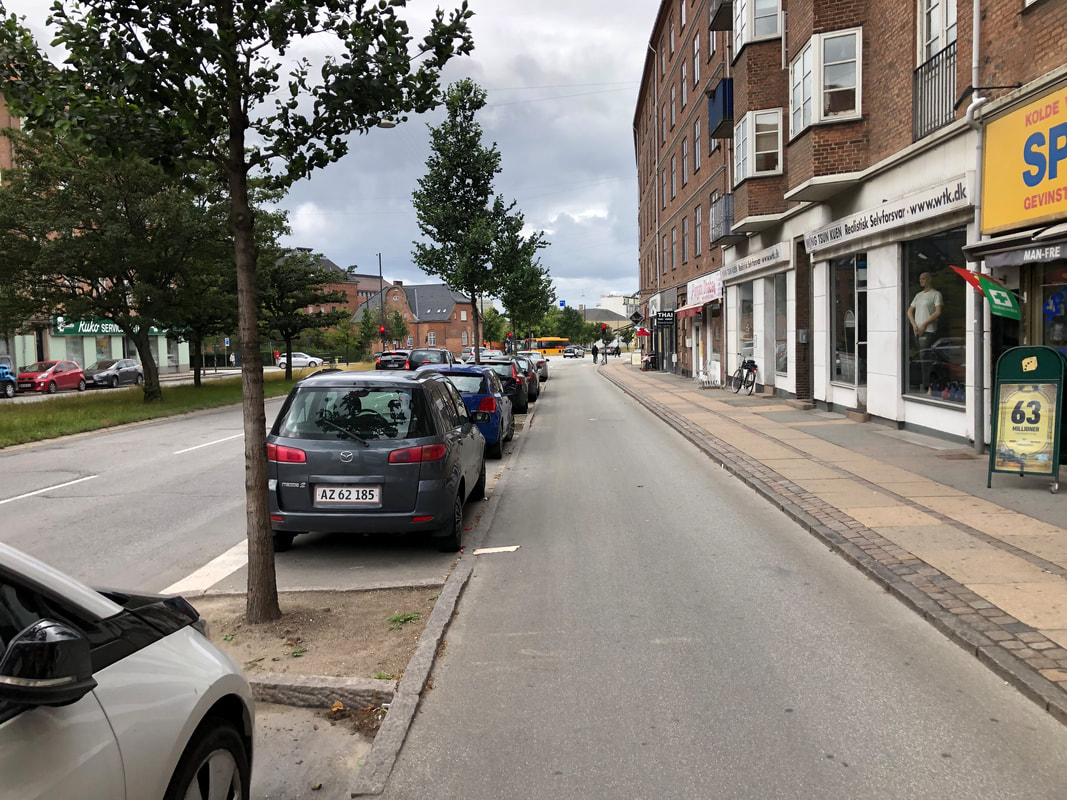
4. Parking. How, what, why? 5. What did public process look like in Netherlands/Denmark as they shifted from auto centric to cycling in the 70s? It was hard to get the full details behind Copenhagen's transformation, but from what we did hear, it was a very deliberate choice to implement bicycyle infrastructure back in the 70s, but it was due to two things: the residents were tired of automobile congestion and using their public plazas as parking lots; and the city was broke. In this sense, they saw the best way to reduce vehicle congestion and the need for parking was to build a network of bicycle facilities. The fact that it has both environmental and social benefits was simply a bonus. And this network was not build overnight. The city of Copenhagen's revenue is funded through property tax and income tax, which results in an approximate effective tax rate of 32% all inclusive. When adding property and income tax in Oregon, this is not entirely different. What is different is where the money is invested: once Copenhagen began implementing the bicycle network, they realized it was much less expensive than expanding roads for motor vehicles. Over the last 30 plus years, the entire cycle network in Copenhagen was built for approximately $320 million US dollars. They simply chose to invest in a bicycle network as opposed to expanding their roadway network. Which brings us to parking. As you'll notice in the city, there is little off street parking and no surface parking lots as the land is used for housing. While car ownership is lower than the United States, this places on-street parking at a much higher premium. As we talked with city officials, they told us over time it became harder to take parking away from residents and businesses, and so they removed travel lanes instead. And this is evident if you travel about the city. The only roads with more than one lane in each direction were 3 or 4 major arterials (state routes if you will). This was learned through public processes for each facility. However, they had a master transportation plan that called for a bicycle network and they implemented it over time. 6. As one of the most bikable cities/countries in the world, are they still innovating? Why/why not? While Copenhagen started constructing bicycle facilities to reduce congestion in a cost effective manner, they have continued to learn, expand and revise existing facilities. Currently, 60% of all city trips are by bicycle, and 49% of urban trips are by bicycle (note this is all trips, not just commuting). They do not remain stagnant however, and are committed to becoming the greenest and most climate change resilient city in the world. They continue to build new bridges for cyclists where needed, continue to add wider facilities where needed and revise facilities that don't work. While there are still many differences between Denmark/Oregon and Copenhagen/Corvallis, they are not as different as many people make them out to be, and many lessons they have learned over the past 30 years could be applied to the Corvallis region and beyond. I hope to include some more photos and drawings of intersections, but for the next few days look for photos of Amsterdam and Utrecht!
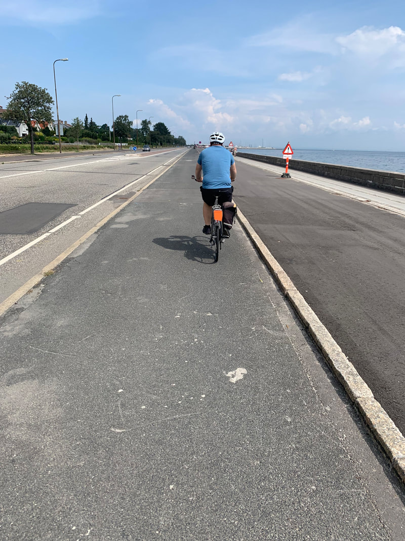
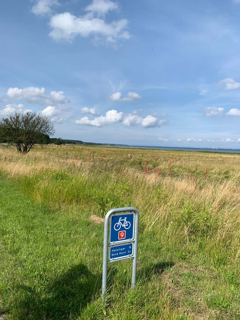
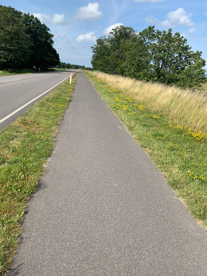
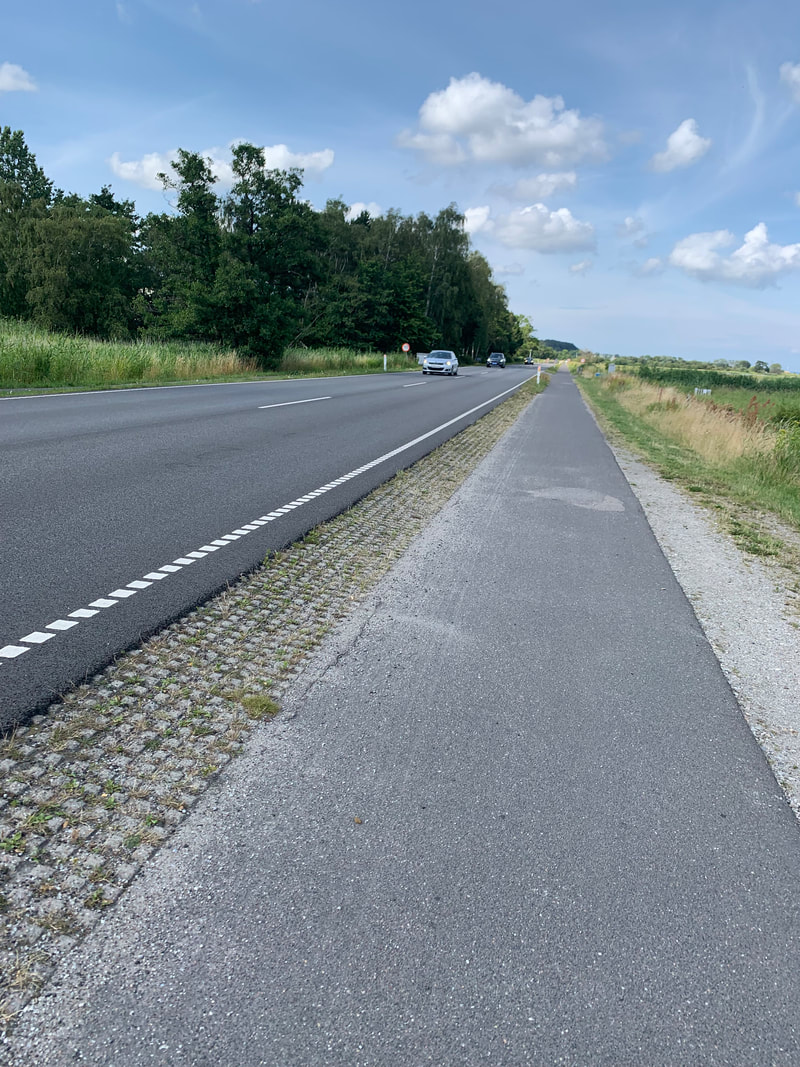
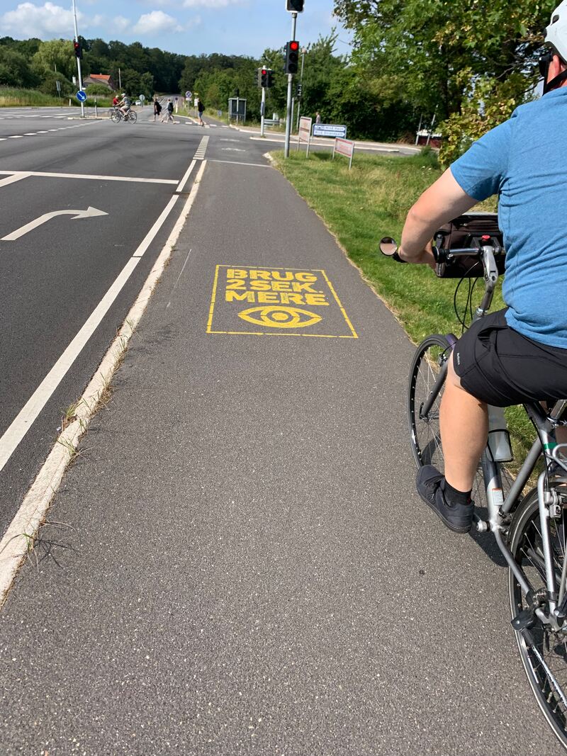
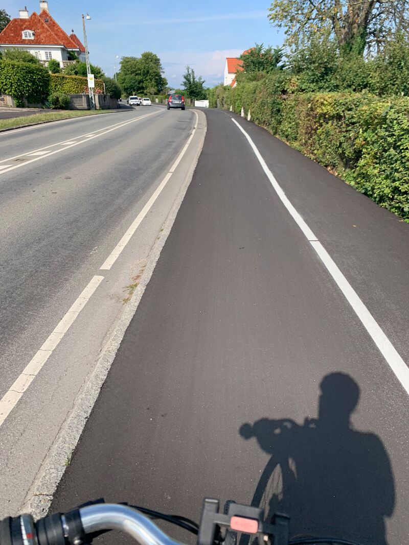
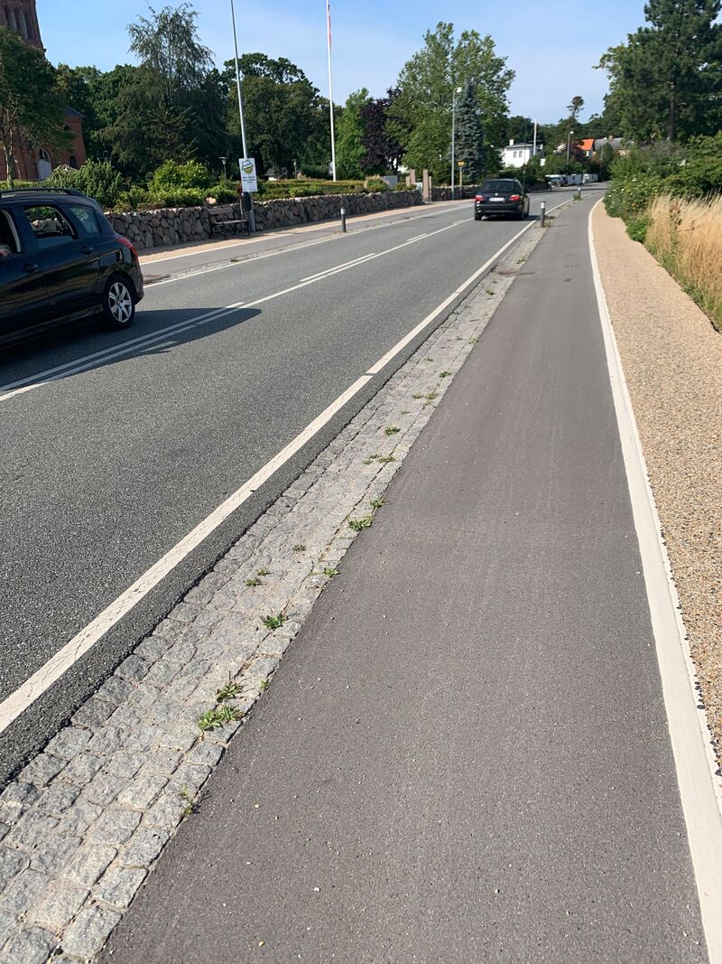
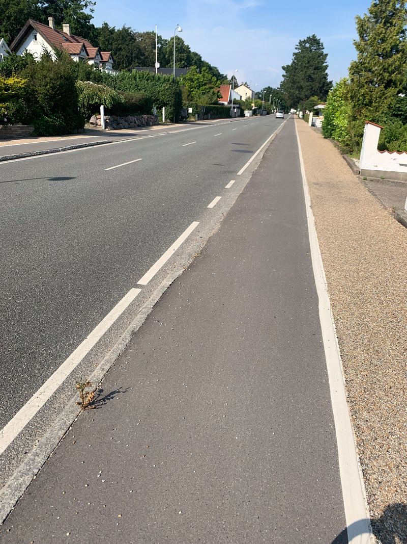
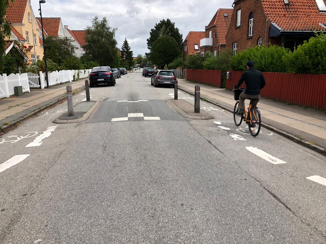
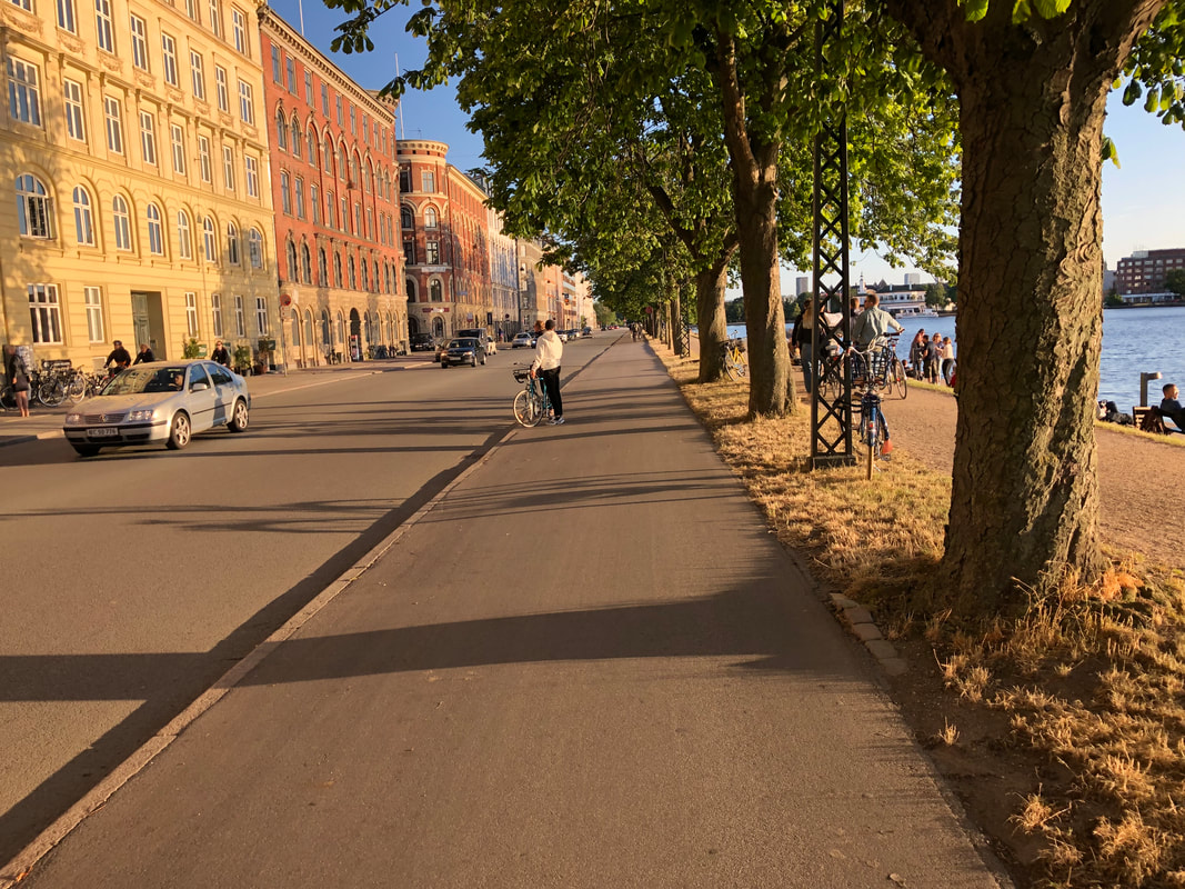
On Saturday, we biked from Copenhagen to Heslignor, a total of 30 miles. An excellent opportunity to see cycling infrastructure outside the (ranked) best city in the world, I had a couple of takeaways. First, the type of facility varied greatly along the route, but unless the route followed a low volume, narrow, low speed local street, it was always separated or protected. This meant the level of comfort for me as a rider never changed, regardless of the environment. Speed limits are also lower along the route, so 70 kilometers/hour, or just under 45 mph was the highest we passed. Second, the route is very well signed, which made it easy (and again comfortable) to travel throughout day and not worry about getting lost or ending up on an unsafe road. This also meant wherever the route needed to cross the street, it was done at a signalized intersection or roundabout for safety.
Third, and perhaps what I thought about most during the day, is the applicability to the Corvallis to Albany bike route currently under development. While the distance between Corvallis and Albany is not nearly as far (11 miles as opposed to 30), many of the sections of the route are rural, pass through farms, small clusters of homes, and connect larger cities. I reflected on some of my earlier posts related to "engineered" vs "designed," and how one approach to implementing bikeways like this is to decide you're going to do it, and then figure out the details to make it work. I would consider this more "designing" it, as opposed to "engineering" a 10 foot wide path with scenic views that requires significant right of way acquisition and costs a lot more. Part of this route was along the road, part was along an active railroad corridor, and part was dedicated path through the woods/fields. However it always felt safe, there was always a minimum of separation/protection, and it was well signed. The system was designed for the end user. I'm looking forward to bringing back the lessons I learned from this day in support of Benton County's project! I've included more details on the project at the link below, as well a number of pictures and map of the route (note the route traveled off highway for a section which is not reflected).
I'm really excited to start talking about what implementation could look like for the greater Corvallis/Cascades West region, but 1) I'm still thinking through some things, and 2) I'm too excited to share some of the "cooler" infrastructure I've come across thus far. The two are a bit related, in that once a community gets really good transportation infrastructure that is more self-sustaining and affordable, it can "upgrade" to the deluxe level infrastructure. Without further ado, here comes the cream of the crop, the best of the best, the transportation nerd love fest on infrastructure:
*according to various sources, Copenhagen is not rich, and this material was used to match the sidewalk at the request of local businesses/residents. Okay, so if you made it this far, here's a little dessert treat:
Okay okay, here's one more, I couldn't resist:
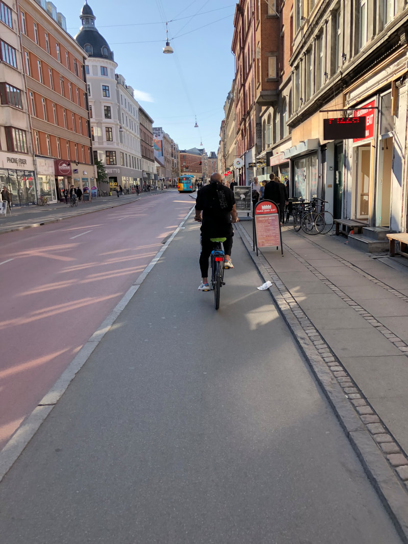
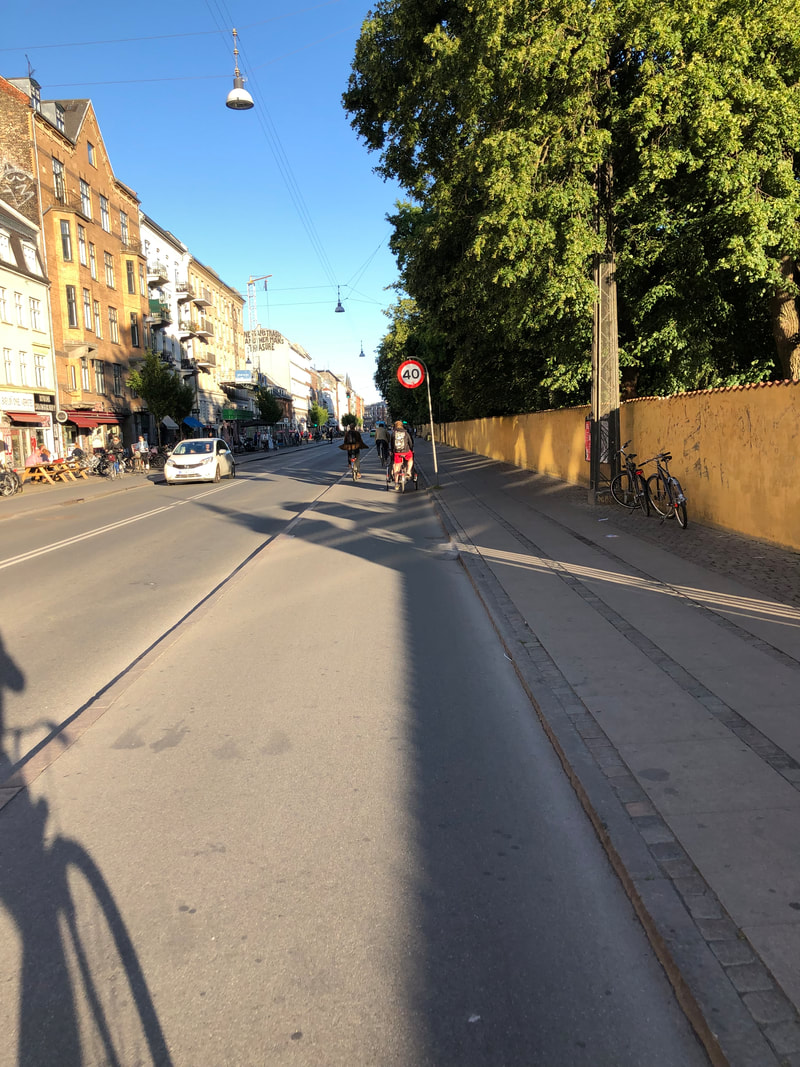
Today involved a history lesson about how different bicycle infrastructure projects came to be throughout Copenhagen, and the challenges the city faced in design and implementation. First of all, the one everyone has been waiting for: as told to us by former city staff, "parking in Copenhagen is a really emotional issue and it's at the center of many concerns over projects." Part of that may be there is little to no off-street parking in much of the city so it is in scarcer supply overall, but it was enlightening to hear Copenhagen deals with the same issue as many American cities (i.e. it's not as different as you think here). We learned that parking is part of a much bigger approach the city has learned over time, about how the same approach does not fit every street, and there are negotiations, compromises, and adjustments that are made on projects even in the "bicycle capital of the world." The first photo illustrates the lack of off-street parking. This is true for much of the center city--the other day we had to cycle 7 kilometers (roughly 4 miles) to find a single family home, and even then it wasn't common to have off street parking in the neighborhood.
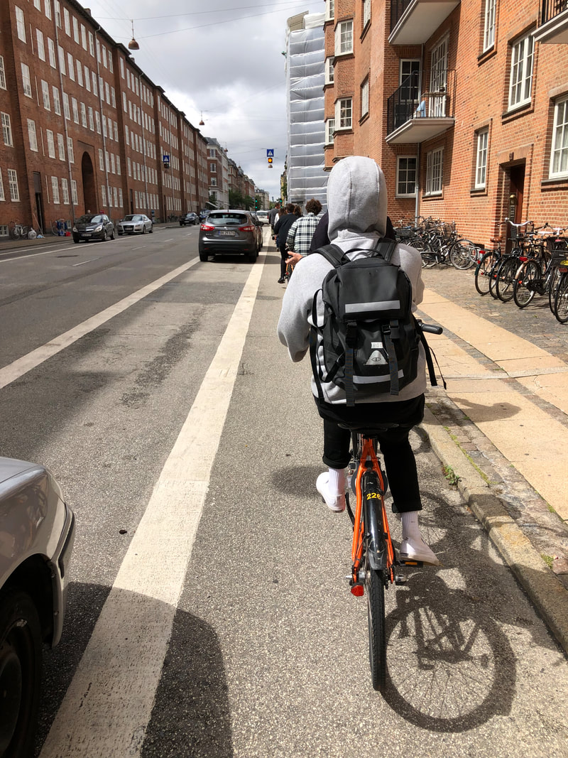
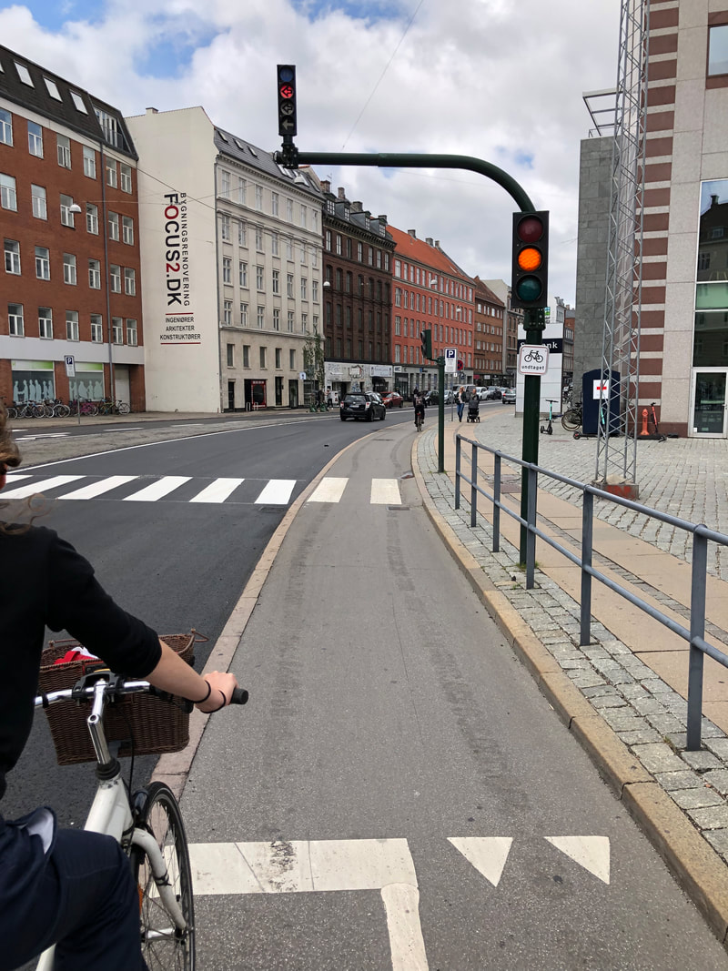
The second photo is the same building looking down the street. While this street was scheduled to have a standard cycle track on either side, it was realized the street supported a lot of pedestrian activity due to the shops along it. Because of this, and not wanting to make the street unsafe for pedestrians, it was decided to make it a shared street, but with traffic calming, This made the street work for all users. The third photo demonstrates the set-back stop line used. When the cycle track was initially installed at this location, there was a safety issue with vehicles turning right and cyclists. To address the issue but maintain capacity for both cyclists and drivers, the city set the stop bar back from the intersection so they would have a better viewpoint to see the cyclists. Finally, the last photo illustrates a project where the design called for cycle tracks on both sides, but this would have required removing parking on both sides of the street. After some more conversations, the cycle track was added on one side, and then the bicyclists travel with vehicles going the opposite direction, but there is also traffic calming. The next block of the street was made one way, and so the cycle track was added in the direction cars can travel the length of the route. I bring up all these examples to demonstrate that one design does not fit every street, and the best city of bicycling in the world has not gotten it right every time. But what they do is commit to their goal of making travel by bicycle the fastest, most convenient mode of transportation, and work out the details as they go. I think this is especially applicable to US cities and the Corvallis region as guidance on bicycle facility design in the US is not fantastic--there are more resources every year, but the most important thing a city can do is start trying; and to try in a way that creates safe and connected infrastructure. And instead of using a design manual to know what a textbook says is safe, think about what feels safe to a cyclist, and what would feel safe for children to ride their bicycles to their destinations by themselves. Today we met with Copenhagenize Design Company founded by Mikael Colville-Anderson, the inspirational speaker in the TED talk in my previous post. I've been following his work since 2008, when I found Copenhagen Cycle Chic, a website dedicated to showing photographs of every day people traveling by bike in Copenhagen. Colville-Anderson's whole point, which he developed into a consulting company, is that it's not about bikes and it's not about "cyclists," it's about people moving about their city to live their daily lives. What we learned at Copenhagenize Design Company is that the City made choices based on their residents desires (less congestion), and these choices (a network of bicycle infrastructure) was not only the cheapest choice, but also the most sustainable. Morton, the President, then went on to describe the four types of bicycle infrastructure in Copenhagen: the shared street, the painted bicycle lane, the curb separated bicycle track and buffered (plus separated) cycle tracks. Each of those examples are below, except for the buffered plus separated cycle tracks--those are more on the regional routes. I thought of a few key differences between this hierarchy and the hierarchy used in the United States; which there isn't clear guidance on, but the National Association of City Transportation Officials (NACTO) has some, and so does the Federal Highway Administration. The first difference is that shared lanes, or sharrows, don't exist here. Streets do exist that are shared, but they are low volume, low speed, and have some traffic calming at one or both ends. These are generally along residential buildings. The second difference I noted is that painted bike lanes ALL have the additional protection parked cars. So there is rarely an instance when a car can veer into you. Curb separated are the most common and the most comfortable to use. They exist on all major arterials and form a network across the city. The network self-reinforcing as well. What this means is that if you make a wrong turn and there's no curb separated cycle track, you can be confident enough that the speed and volumes are low enough on the street you're on that you can continue on your journey. There was a specific request to look for examples of shared streets so I have a number of photos demonstrating more details below. You'll see large granite blocks are used not to stop vehicles from entering, but merely slow them down. There is traffic calming to slow cars down and make them unable to avoid the hump, while also having space for bicyclists to easily pedal by. And there are material transitions used to help differentiate the space for primary users. The engineering half of my brain has gone into overdrive the last two days, thinking about how people who bicycle are accommodated through various designs in Copenhagen. There's an old TED talk from 2012 (see below) that I first saw 6 or 7 years ago when I was in graduate school and became interested in bicycle transportation. It's a by Mikael Colville-Anderson who talks about how we got the urban form and focus on cars we have today, but more importantly, what good infrastructure looks like. It struck a chord with me because he discusses the difference between engineering and design. Engineering is using computer models and paper maps to assume how people will use a facility, whereas design involves thinking about what is best for the end user, and then creating a system that works for them. Maybe that's a bit of semantics, but to me it makes perfect sense when you bike around Copenhagen. The system is designed for people who bike, down to the signals, intersections, parking, and train. So what exactly does this mean, a system that is "designed" for people who bicycle? In the United States we have the Manual on Uniform Traffic Control Devices (MUTCD for short, last fully updated in 2009, which prescribes every type of intersection you might encounter, what it should look like, the markings to use, the number, size and location of signals. There is little guidance, or even images, of people walking, or biking or interacting with cars and intersections. Yet in a dense city, oftentimes people significantly outnumber cars at every intersection during the busier times of day. The TED talk goes on to describe that a city "designed" for people is one that is intuitive and easy to navigate. In the United States we've made it easy for people to drive everywhere, and for the most part we've made it intuitive (yet there are still 40,000 deaths a year from traffic crashes). In Copenhagen, they've designed the city for people who bicycle. What does this mean? They've made it natural, intuitive and easy to navigate, travel and park bicycles. When a bicycle lane crosses an intersection, there are pavement markings directing you from one end of the lane to the next. Bicycle signals are at the rider's height and have a small symbol to illustrate who it's for. Parking options are abundant, yet it's also "allowed" to park anywhere that's not in the way of the sidewalk. Construction sites have dedicated lanes for bicyclists to use if they're blocking the lane, and every transition from one grade to another where a bicyclist may traverse has a small ramp to make it easier. In a way, what the United States has done for cars, Denmark/Copenhagen has done for bicyclists, and it's in this way that travel by bicycle is the most common and preferred way to travel. While the transit system here is robust (3 minute train headways on a Sunday), bicycle travel is competitive with transit for short distances. Below is a screenshot from Google maps where you can the fastest way to get somewhere was by bicycle. 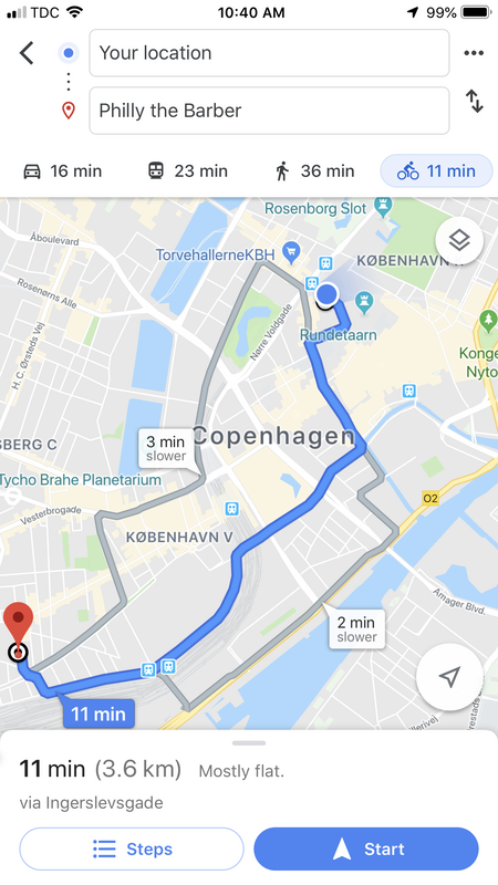  After landing in Copenhagen after a long travel day and little sleep on the overnight flight, I stumbled through buying a transit pass and took the Metro into the city to meet up with the group. When I walked up out of the subway, the first thing I saw was the above image, which was pretty much everything I expected: public space, 4-6 story Scandinavian style buildings, and bicycle lanes! Two other observations I immediately noticed are the sidewalks are relatively narrow when you add in shop signs, etc. and parked bikes, and that vehicles park in the bike lane/sidewalk even in Copenhagen (notice first photo below). After meeting up and introducing ourselves we biked around town and met up in a park for pizza. While there are still people that drive, the majority of people get around via bicycle. And part of the reason is because nearly every major street has curb separated cycle tracks, and they are WIDE. They allow for bicyclists of all ages and abilities to go different speeds, pass if needed, and ride next to each other. On our ride home later in the evening, I saw three teenagers--two on bikes and one on a scooter, going out on a Friday night and they were all just so happy being able to ride next to each other, regardless of mode (last photo). To me, that should be the goal of transportation infrastructure: teenagers should be laughing and joking as they travel to their destination because if they feel that comfortable, then they feel safe. Another infrastructure related observation I had related to the grade separation. In the United States, the major push right now is for protected infrastructure using vertical separation such as planter boxes, a 6" vertical curb (while the lane lane remains the same level as the street), or some sort of vertical posts. In my limited travel thus far, there is nothing more than the 2-3" curb between the vehicle lane and bike lane, and then another couple inches between the bicycle lane and sidewalk. Granite curbs are also used extensively here--which is common in New England and northeastern states, but very rare in Oregon, where integrated concrete curbs are used. This has potential impacts on construction, which I'll discuss more in a later post. We're meeting with a local design firm on Monday in which I hope to have a more in-depth conversation about design and construction details. My next post will focus on other travels around Copenhagen, as well as some notes/thoughts on how intersections are dealt with here. With two and half weeks until I leave, I'm anxiously trying to finish up things at work in order to fully focus on the trip. At our last Policy Board meeting before I leave, I asked both elected officials and local staff for issues or questions they have related to transportation that I could try and find some answers or best practices too. The following is what I wrote down:
I'm looking forward to trying to answer some of these questions as we travel through the country. The lead professors, Marc Schlossberg and Rebecca Lewis provided a list of readings in preparation for the trip, which I have linked below. Are there any other questions you have? Or recommendations?
|
|||


 RSS Feed
Photo used under Creative Commons from Ivan Radic
